
Exactly 3 months after my first flying lesson I started my final exam to become a certified Private Pilot. June 19th 2024 to September 19th 2024. We completed the oral portion of the exam on the 19th successfully after a couple of hours in a conference room with me answering questions about flight planning, rules and regulations, decision making, etc…
We were going to do the flight portion the same day, but due to weather and scheduling it took a few days to finish the actual flying portion of the exam, and that got done on September 22nd 2024.
I’m going to count it as a 3 month journey though!
It was a great morning to go fly, definitely worth getting up early for. The air at 7AM is lovely and smooth, no crazy thermals yet, and the winds haven’t picked up.
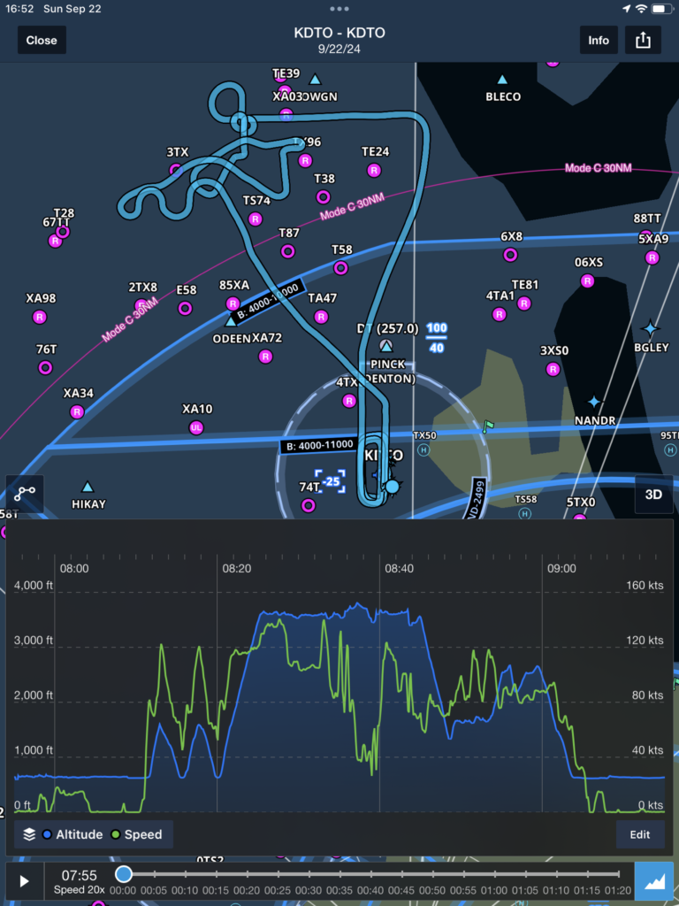
We did our landings first because there was nobody else flying yet really, and it was great to get that done in the super smooth morning air. It’s much easier to get super accurate soft landings when the hot texas sun hasn’t heated up the ground and started creating thermals yet. Then we took off on our simulated cross-country flight, and pretended to do a diversion to an unfamiliar airport. Navigated to that successfully, and we started doing some maneuvers. Everything went really well, but by the end when we were doing our S-Turns the winds and thermals were starting to pick up so it started getting a little tough. You can see the S-Turn over there on the upper left though, it doesn’t look too bad! Then we headed home! Long as you can land the plane safely it’s a pass, no pressure now!
After the landing, the examiner asked me if I was left handed. I’m not, so he asked if I was left-eye dominant. I am! He diagnosed this as the cause of why I’m always slightly to the left on my landings. Which, in retrospect, I should’ve absolutely realized. Cross-dominance has always been a problem for me with shooting as well! Next time I land I’ll close my left eye for a second to check my alignment, and I should be able to land dead center. The good news is that left-eye dominance means I won’t have any trouble staying right on centerline when I’m an instructor and sitting in the right seat.
What this means
The Private pilot certificate is the first level of license you get. This allows me to fly on my own, pretty much anywhere I want to, as long as the weather conditions allow it. I can’t fly in weather that prevents me from seeing the ground or requires use of instruments. I can only fly up to 18,000′ above sea level. I can’t get paid to fly at all, but I can carry passengers now!
And starting tomorrow we start learning to fly with instruments only! (IFR)
Once I get that certificate too I’ll be able to fly even when there are clouds and I can’t see the ground. After that comes the Commercial certificate, which will allow me to get paid to fly airplanes. Both of these next certificates require largely “time building”, or just practice. For example the biggest chunk of the requirements to get your IFR certificate is having 50 hours of practice doing cross-country flight. (Anywhere over 50 miles away from your starting airport.) So it’s time to get out there and do some flying!
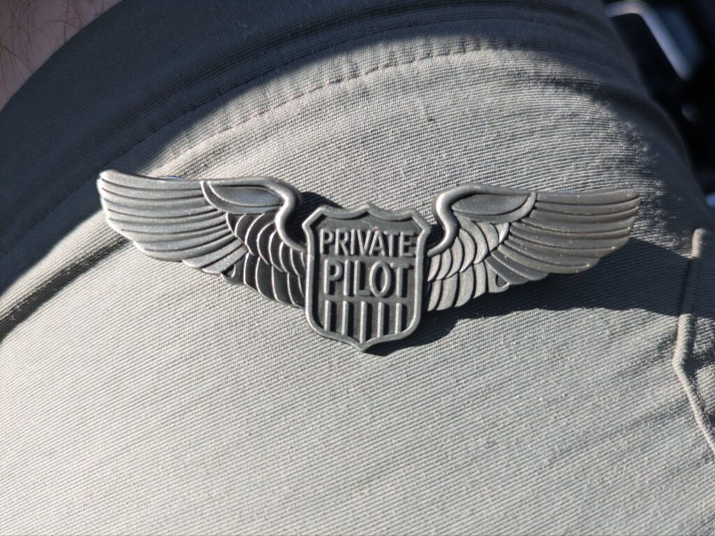
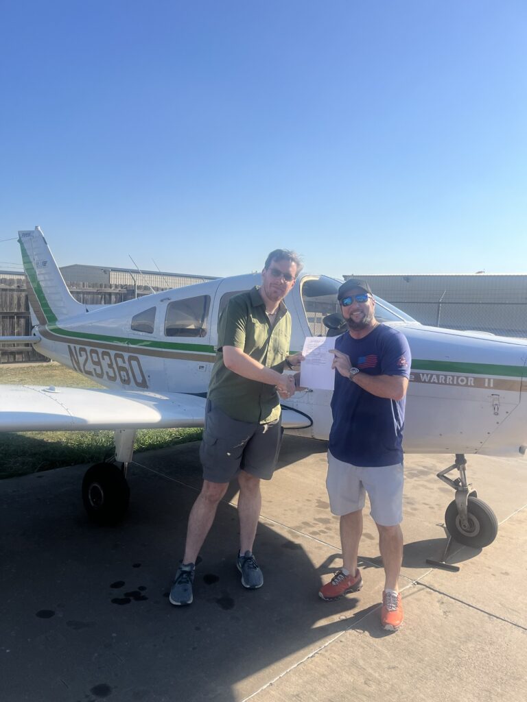
After we were all done with the exam instructor Nathan and the school owner Torrey gave me a pin. I earned my wings! 🙂
The Private Pilot certificate is commonly called your “License to Learn”, because now you’re at a stage where you’ve still got a lot to learn. There’s a lot of things I’ve barely experienced, or haven’t experienced at all. So the main idea now is to try and get that practice, and try and get exposure to as many things as possible! Try flying into unfamiliar airports, try navigating in areas you don’t recognize landmarks for, learn to fly some different planes, learn to fly around mountains and over water, all sorts of fun things.
Stats
In my 3 months of training I have logged 48 flying lessons, 3 ground lessons (I did most of the ground school stuff as self-study before I even started flying), and my total logged time flying the plane is 79.9 hours as of the end of the 1.3 hour checkride.
56.8 hours (34 flights) were in Piper Warrior PA-28-161s.
10.5 hours (7 flights) were in Piper Cherokee 180s.
12.6 (7 flights) were in a Cessna 172.
23 flights (36.2 hours) were with my primary instructor Nathan, 13 flights (22.6 hours) were with my secondary instructor Edwin, and 3 flights (5.2 hours) were with Maddie, who, being one of our mechanics as well as an instructor, schooled me on how to best keep the planes happy and healthy! All in all that makes 64 hours of instruction received.
I flew 9 flights, for a total of 14.6 hours, solo.
I have landed the plane a total of 269 times, 195 of which were touch-and-gos where we land and just take back off again.
Nautical Miles
In a comment on my last post Marcia asked about Nautical miles. It’s a good question, so here’s the quick answer:
A statue mile is 5,280 feet. A nautical mile is slightly longer at 6,076 feet.
Both ships and airplanes use Nautical miles rather than the regular (“Statute”) miles for navigation because we talk about navigating over very large distances where the curvature of the earth starts to matter. A nautical mile is based on the size of the earth at the equator. If you were to look down at the earth from above the north pole and imagine the circle of the equator. Divide that circle into 360 degrees. These are the lines of longitude you might be familiar with. Take the space between any two of those degree lines and divide it into 60 smaller lines. These are called “minutes of arc”, and that’s a nautical mile. 60 nautical miles * 360 degrees of longitude means it’s 21,600 nautical miles to go all the way around the equator.
And a “knot” is miles-per-hour in nautical miles. So 60 knots is 60 nautical miles per hour, or 1 degree of longitude per hour, which means it would take you 360 hours, or 15 days to go all the way around the equator at that speed.
So basically navigation over long distances uses “Nautical” miles because they divide more easily into the latitude and longitude lines on the map, and makes it easier to go back and forth between GPS coordinates and distances.
Just one of those weird things that you do to make life easier when you have to deal with living on a sphere rather than a nice flat map.
A big congrats from Dave and me. We couldn’t be happier for you!
And thanks for explaining nautical miles. Before you explained, I just thought it was for boat captains who liked to use fancy words. Lol.
Dave and I can’t wait for you to take us up in the air. It’ll be one at a time, right? Do the planes you’re flying only have two seats?
Anyway, congrats again!
Great job Josh, we are proud and happy for you to be making this journey.
Your synopsis is a great read, I wish when I was on this journey I had taken the time to journal my experience. But with age comes perfect hindsight….. lol
Echoing what Marcia said, I too can hardly wait to go flying with you, that will be a real treat.
The planes we train in down here are technically 4-seaters, but the backseat isn’t very big.
I’m looking at some options for what planes I can familiarize in that will be good for taking multiple passengers! Also looking into maybe coming up to SEA/PDX to take some lessons in flying up there specifically too!
We’ll definitely figure out a plane we can get into!
I don’t need you falling off the wing on me though, gotta make sure that back is in working order! 😉